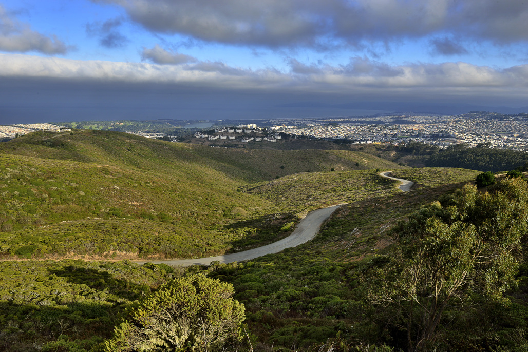

The area is at the northern reaches of the Santa Cruz range. The park provides Bay Area visitors with day-use facilities, hiking trails, and beautiful views of the city and the bay. The park is home to a wide variety of birds and animals as well as several endangered plant and butterfly species.
The Mountain's ridge line runs in an east-west configuration, with considerable slopes and elevations ranging from 250 feet to 1,314 feet at the summit. The landscape offer excellent hiking opportunities and outstanding views of San Francisco and Central Bay Area.
Location/Directions
From Highway 101, take the Bayshore Boulevard/Brisbane exit. Continue on Bayshore Boulevard to Guadalupe Canyon Parkway. Turn west on Guadalupe Canyon Parkway toward the Mountain and go to the park entrance.
From Highway 280, take the Mission Street exit. Go north on Mission Street to Market Street. Turn right on Market street and proceed northeast. At Guadalupe Canyon Parkway, turn right and go eastbound to the park entrance.
Seasons/Climate/Recommended clothing
The weather can be changeable; layered clothing is recommended.
Activities - Facilities
Hiking is the most popular activity in the park. The main starting points are from the park's entrance or from Radio Road at the mountain's summit. Various neighborhood access points, including Crocker Road and Charter Street, also provide good starting points.
Sightseeing is also popular. Radio Road, leading up from near the main entrance, affords visitors the opportunity to drive to the summit of the Mountain and enjoy breathtaking views north to Mt. Tamalpais, south to Mt. Diablo, east to the Oakland foothills, and west to the Farallon Islands.
At the summit, visitors can see the remains of an old Nike Missile early warning radar site. This radar, with others around the bay area, was used to detect approaching enemy aircraft and direct the missiles to their target.
The park has family picnic sites near the park entrance. Tables, barbecue pits, drinking water and a restroom are also available. The nearby meadow can be used for volleyball and frisbee. All facilities are accessible to people of all abilities.
Collecting or destroying anything in the park, including mushrooms, is prohibited.
San Mateo County operates San Bruno Mountain SP -- please visit their website for additional information.
San Mateo Parks and Recreation will have detailed information about this park.